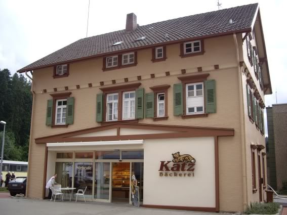
Former Terminus at Altensteig, now a bakery
Long ago the people of the Nagold valley (about 20km south of the fictional Körsch valley) transported their logs in rafts on the river, in similar style to American loggers. Here, river pilots would build a wooden dam with gates, wait until there was enough water, then open the gates and ride the wave for a few kilometres until the next dam. It must have been a pretty exciting existence: the mind boggles as to what happened when several tonnes of sodden pine came shoshing around the corner and met something unyielding. Nonetheless, until about 150 years ago this was the way of shifting wood from the Nagold to the Neckar river, and on to the Rhine and Holland. And to think now people pay to do this sort of thing.
All in all I expect most people were relieved to let the railway take over. The metre gauge line from Nagold to Altensteig opened in 1891, but only lasted until 1967 before the prevailing wisdom turned to roads. This seems a great shame as the town now has all manner of industry, not to mention tourists coming to the old city, so it seems sad they didn’t keep going with rail. All that is left of the railway is a few buildings, a wagon planted alongside the road, and a cycleway.

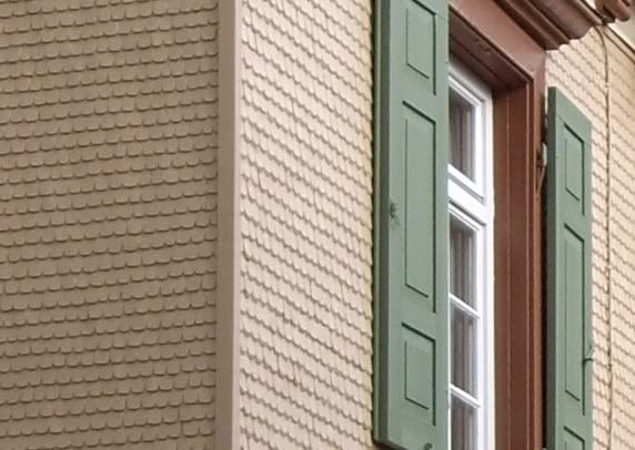
Station detail showing the intricate shingles... Perhaps I'll just have a plain wall...
All of which doesn’t leave a lot to go on. I was hoping to have a good look at the line and the area to get some thoughts on how the Körschtalbahn (KÖB) could have been constructed, how it could look, and what it could carry. Judging by the Altensteig line, the KÖB would have followed a road most of the way with occasional short detours through villages or round hills. By the looks of it, frequently lurching across the road would be in order as well. The stations are typical European pattern: Goods shed with station alongside, the sort of thing that should fit onto the back of the layout. The low-key way the railway squeezed between buildings is very attractive although I haven’t any ideas yet how to make it happen- perhaps have all the buildings a few degrees different to the track, to give an impression of “The buildings were here first” and possibly “added-on” loading bays to take advantage of the loading possibilities. I have some pictures of local building to give me an idea: I'll post those, along with some thoughts on traffic types soon.
Now. How do I make shingles?
[Update, 13th of June 2007: Our pastor (who grew up in Altensteig) loaned me book on the line so I can actually see what it looked like and where it ran. I'll read it through -which may take time as it's in German, and inflict my thoughts on you later]
 Altensteig railway station
 The Feuerwehr training: Lights and everything, to the delight of the oldest boys.